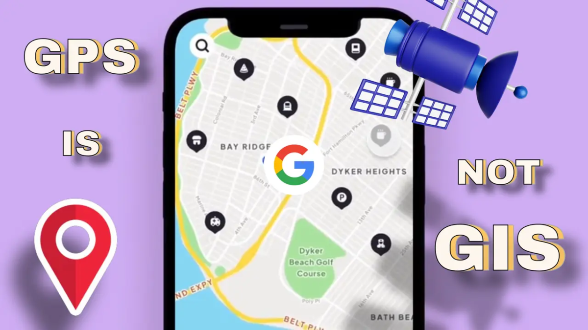
GPS services used by most of us are a part of GIS but not the GIS as a whole!

Then What Is GIS?
Let’s explore What is Called GIS, and how it is used in day-to-day life.
Have you ever thought in this way? While you are going to school or the office daily, how many things do you observe on the way?

You may see a roadblock due to construction works for the metro going on!
So many things you see hear and feel!
Your favorite bakery, which you might want to visit later!
Unsafe road due to manhole or open drainage?
Numbers of cars and scooters at the cross-road or
A railway crossing or a number of bridges coming across your route!
But what if I tell you that all this information is vital for town planners, engineers, epidemiologists, and people like us?

And how useful it is, if we have all this information in a spreadsheet like the number of routes available to reach your school or office, peak traffic hours, and so on.
So, what wonders it can do if all this information is on the map?
Now you can decide the shortest route or you can avoid traffic to reach your office.

When you are thinking this way, you are using GIS data!
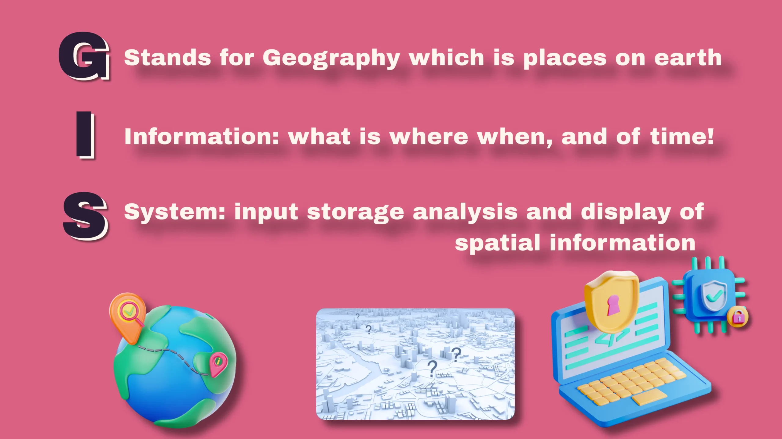
GIS Definition
G Stands for Geography which is places on earth
I Stand for information: what is where when, and of course time!
S Stands for the system: input storage analysis and display of spatial information using software & hardware.
GIS-As Layers Of Data!
Haven’t you used a location service like Google Maps? known as GPS navigation is a glimpse of GIS!
However, the GIS has more data in the form of layers, and layers are built from the actual world.

As GIS understands the location and has a database attached to the layers, it can help answer very complicated questions quickly.
Think about the route you are taking to reach your office.
Will the closing down of the particular bridge impact the traffic and other emergency services in particular?
How many hospitals or fire stations linking that bridge?
And, now Civic bodies can prioritize which road to be repaired first based on traffic loads.

And you know what! The impressive aspect is that (GIS) has the capability to perform this task for any type of information, not exclusively limited to roads.
This technology can effectively handle and assess a variety of data in your everyday tasks.
So, GIS stores data as layers, And layers represent the real world.
Layers What Are They Made Up Of?
Layers are made of spatial and non-spatial data. Spatial data is nothing but geometric shapes, points, lines, and polygons.

And, each of these shapes is tied to its real-world location on Earth, using latitude and longitude coordinate systems and that’s the real magic behind geographic information systems.
And, If the data is 3D-enabled, you’ll find a third coordinate, elevation, which is the height above sea level.
Things which does not have any dimension are the points, for example, Hospital locations, cases, crime spots, etc.
While roads and streets can be represented by lines.
Polygons are for the area to show length and width, examples are city or country boundaries or farm fields, etc.
A simple model is shown in two dimensions, but a more advanced one can be created in three dimensions, to display the height of buildings and other structures.
Components Of GIS

GIS consists of software, hardware, data, methods, and people using it.
Softwares are like, All the computer programmes/apps used to handle, manipulate, and analyze data, like ArcGIS and Q-GIS.
Hardware Range from computer system to satellites used to capture the GIS data.
Data is spatial and non-spatial data that we already talked about.
And people: From tech specialists, and trainers to those who use it to solve problems using GIS technology.
I hope now when someone talks about GIS you will understand what h/she is talking about!
FAQs
How does GIS work?
GIS works by integrating various components such as hardware, software, data, methods, and skilled personnel. Spatial data is collected, stored, analyzed, and visualized to gain insights into geographical patterns and relationships.
Can GIS be used for personal purposes?
Absolutely! GIS has applications beyond professional use. Individuals can utilize GIS for activities like trip planning, geotagging photos, or creating custom maps.
What industries benefit the most from GIS?
GIS benefits a wide range of industries including urban planning, agriculture, healthcare, natural resource management, logistics, and more.
Is GIS limited to desktop applications?
No, GIS has evolved beyond desktop applications. With the rise of mobile devices, cloud-based platforms, and web-based mapping tools, GIS is accessible from various devices and locations.
How does GIS contribute to disaster management?
GIS plays a critical role in disaster management by providing real-time information on affected areas and aiding in evacuation planning, resource allocation, and damage assessment.
What skills are essential for a career in GIS?
A career in GIS requires skills in spatial analysis, data manipulation, cartography, programming, and critical thinking. Strong communication skills are also vital for interpreting and presenting findings.
Add a Comment
You must be logged in to post a comment